|
|
|
|
|
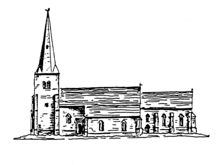
The Saxon Church Why was it sited there? The obvious and much quoted answer is that it was built in a central position to serve the surrounding villages as the mother church. In that respect it stood at the crossroads of the Ruddington – Plumtree road and the Keyworth – Edwalton road. Another incentive is the geographical position on a slope above the majority of the surrounding villages. It has been said that Flawford was a 'lost' village but this is completely untrue. A village was never built around this church An added incentive to build there may have been that the ruins of the previous Romano-British villa would provide some of the building materials for the church. To substantiate that fact some Charnwood Slates from the villa were found in the debris of the church. There is a near certainty that the Saxon builders utilised the 2nd century tessellated floor in their nave and thus provides a structural continuity from the Roman-British time to the Saxon period. This is not an uncommon aspect of Saxon churches and other churches have been built on similar lines e.g. The Cathedral, St Albans; Brixworth, Northants and Old Minister; Winchester. Was there a Christian tradition here prior to the stone Saxon church? Two east-west burials, presumably Christian lie beneath the foundations of the early Saxon name thus predating the stone church. This could have meant that there was a possible earlier timber church elsewhere on the site. It could also mean that the villa was lived in by Christians. It is known that some villas had ‘house chapels’ which were probably used by both those living in the villa and those working on the estate. The finding of a silver penny of Burgred, King of Mercia 852-74 and another of Alfred 871-99 amongst the scattered tesserrae and within the church may be a useful pointer in dating the building, form this is would seem that the church was in use in the late 9th century the Danish invasion and conquest of Mercia in the 860s and 870s make that an unlikely period for church building. Perhaps a more probably date might fall within the first half of the 9th century. A small Saxon church probably early 9th century existed here. It evolved in ten phases to a large medieval church.
What was happening around Ruddington at the time The ninth century Nottinghamshire was part of the Kingdom of Mercia. It was invaded by the Danes and in 868 AD the Danes had captured the town of Nottingham. By the time of King Alfred, Nottingham along with Derby, Leicester, Lincoln and Stamford had formed a strong Danish confederation and in all of these five towns the Danes had a numerical superiority. During the reign of Edward the Elder, Alfred's son. the Danes had joined forces with the rebel Saxon King Ethelwald and were creating chaos in Mercia. In 919 AD Edward raised an powerful army and recaptured Nottingham and garrisoning the burgh with English and loyal Danish soldiers. In 924 AD Edward revisited Nottingham and had a bridge built on the site of the ancient ford, hence Bridged-ford. It is also recorded that he built a burgh on the south bank of the Trent. This would have been a fortified outpost sited so as to defend the town against an attack from the south. The following passage referring to this burgh comes form 'Bygone Nottinghamshire' by Wm Stevenson in 1893 'Wilford Hill - two miles south of the bridge over the Trent on the ancient north road from Leicester via Nottingham, Bawtry and Doncaster to York. The south and highest portion of this eminence is figured in the Ordnance Survey charts as Mickleborough Hill. The primitive meaning of this would be "the great hill", but the ordinary meaning contemporary with the nomenclature of the county is "the great burh or fort". This is accepted as the site of the burh on the south side of the Trent, constructed by Edward the Elder in 924 AD to guard the crossing of the Trent on the south bank as the burgh of Nottingham "inhabited by Danish as well as English people" did that of the northern bank, the special occasion being the building of a bridge at this important ford or crossing. This ancient road is cut or worn deeply into the high land from which cause it had fallen into disuse and is now a green lane o'ershaded by a group of tall but picturesque firs. The modern road is a diversion to the west, constructed to avoid this narrow way climbing over the hills.' Stevenson gives no evidence to support his sweeping statement that, "This is accepted as the site of the "burh on the south side of the Trent." It is a fact that Nottinghamshire place name authorities interpret Mickleborough as meaning, a big. hill and, there are other examples in the country where it is used as such. However, the Anglo Saxon word "burh literally means a fortified place. Since, at the present, we have no positive evidence to support Stevenson's claim, it is at least possible to consider where else the burh could have been situated if it were not on Mickleborough Hill, Until recent times the Trent has been subject to flooding. On the north side the names the Meadows and Boardmarsh, gives evidence of that and the same was true of the low land to the south of the river. During the 1930s the flooding of Wilford and Bridgford was almost an annual event. This would rule out the probability of a burn close to the river, in fact it would have been quite pointless to have sited a burh anywhere
|
||
|
Mid Bronze Age Building the Church phases 1-5 Building the Church phases 6-10 The Chantry Chapels of Flawford Where to find the evidence The Hermitage Museum Glossary Contact us Site Map Links
|
||