|
|
||
|
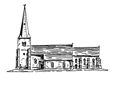
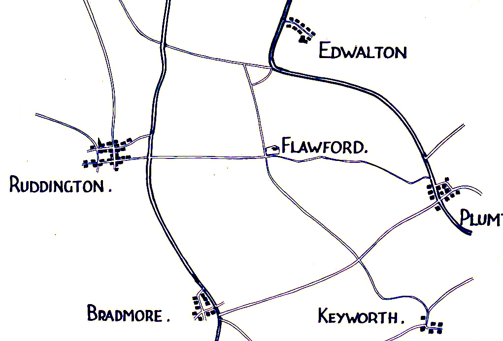
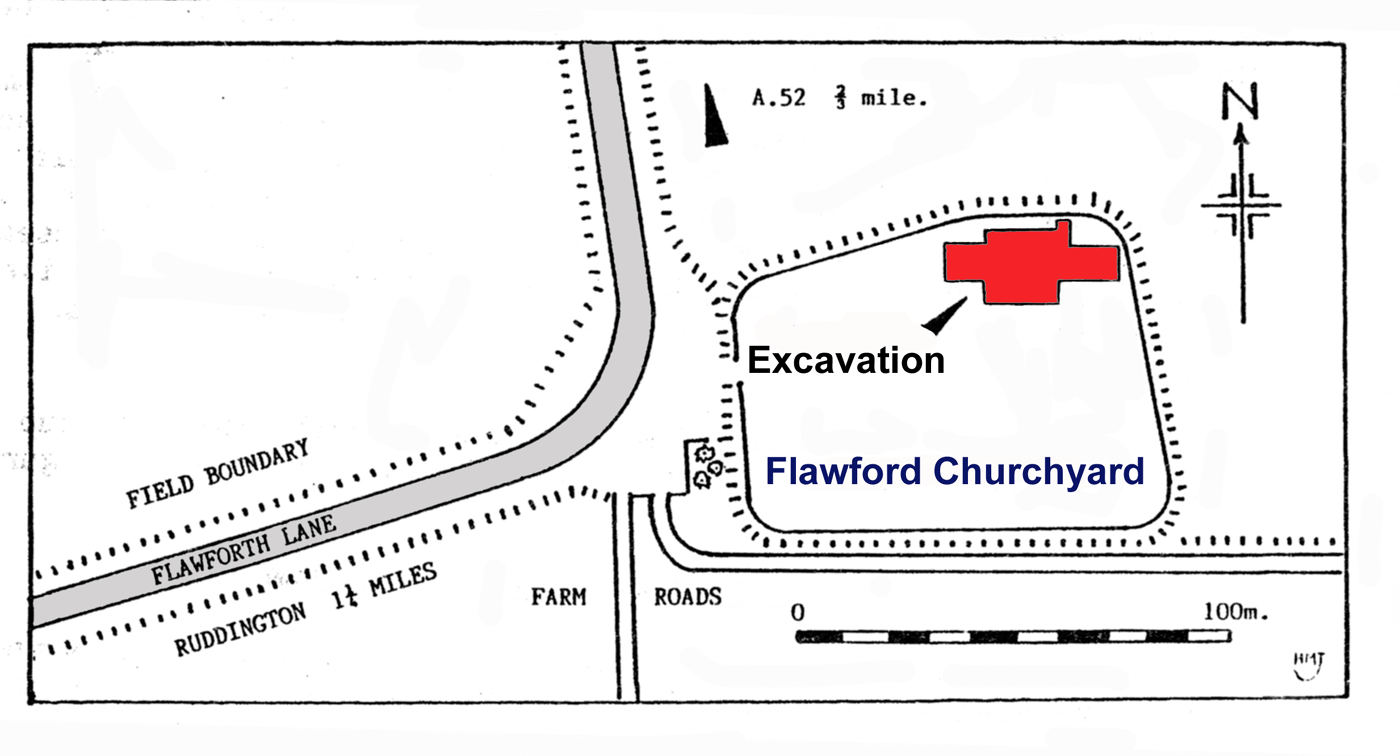
Where is Flawford? Flawford Church lies in Nottinghamshire south of
Nottingham and 1½ miles east of the village of Ruddington at an
ancient crossroads from which it is reached by Flawforth Lane.
It is situated in an area of flat farmland which rises gently in the distance. From the northern boundary of the churchyard the ground slopes away to form a gentle escarpment. The sub-soil is Keuper Marl with bands of Lias which comes close to the surface. The Lias is a period of Geological time towards the end of the Early Jurassic that is from around 195,000,000 years ago until 180,000,000 years ago. It is an area that is particularly well drained and favourable for cultivation.
The road system
The
two missing branches ran eastwards to Plumtree and southwards to
Keyworth. The roads lead east to
west from Ruddington past Flawford to
the village of Plumtree. There was also another north – south road
from Edwalton, now a suburb of Nottingham through to Keyworth
village. Flawford was therefore lying in a central position as the
mother church for the four villages.
The road system has been altered over time and Flawforth road runs from Ruddington and takes a right angle to turn north at the ancient site to travel towards Edwalton. The Plumtree road still survives as a bridle path and the Keyworth branch can be seen as a farm road and footpath as far as Blackcliffe Hill from which point there is a gap of about half a mile.
|
||
|
Mid Bronze Age Building the Church phases 1-5 Building the Church phases 6-10 The Chantry Chapels of Flawford Where to find the evidence The Hermitage Museum Glossary Contact us Site Map Links
|
||
 Flawford Church lies in
what was an important crossroads. At the entrance to the
churchyard the road form Ruddington turns sharply north to join the
South Nottingham Ring Road at the Lings Bar traffic island. there is
evidence from early maps anmd from indications on the ground that
the road from Flawford to Rudidngton and to Edwalton once formed two
branches of a croosroads.
Flawford Church lies in
what was an important crossroads. At the entrance to the
churchyard the road form Ruddington turns sharply north to join the
South Nottingham Ring Road at the Lings Bar traffic island. there is
evidence from early maps anmd from indications on the ground that
the road from Flawford to Rudidngton and to Edwalton once formed two
branches of a croosroads. 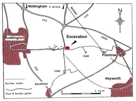
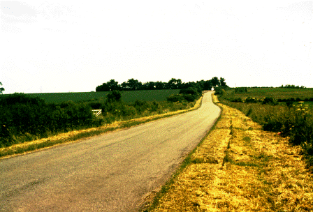
 The Keyworth end is still
recognisable leading out of the village. It is likely that through
lack of usage resulting in from the neglect and eventual demolition
of the church, the roads became unrecognisable. Lawson Lowe in 1874
wrote that the Plumtree road was an " ...ancient causeway
paved with stones and disused since the church was destroyed, (and)
can only be traced when the corn along its track bear a half
blighted aspect and the grass prematurely ripens."
The Keyworth end is still
recognisable leading out of the village. It is likely that through
lack of usage resulting in from the neglect and eventual demolition
of the church, the roads became unrecognisable. Lawson Lowe in 1874
wrote that the Plumtree road was an " ...ancient causeway
paved with stones and disused since the church was destroyed, (and)
can only be traced when the corn along its track bear a half
blighted aspect and the grass prematurely ripens."